
All photos are by Susan Tichy, unless noted, and all are from the Colorado Sangre de Cristo Range and adjacent Wet Mountain Valley. Automated location software may place some in the Great Sand Dunes National Park (which lies to the west, just over the crest of the range at its southern end), but none were shot within those boundaries
In 2008 I walked among freshly-decapitated trees from a late winter avalanche in Huérfano Basin. Alas, the hard drive holding those photos will not power up from my laptop, and the cord that may revive it is at the other house. So these will have to do for now.
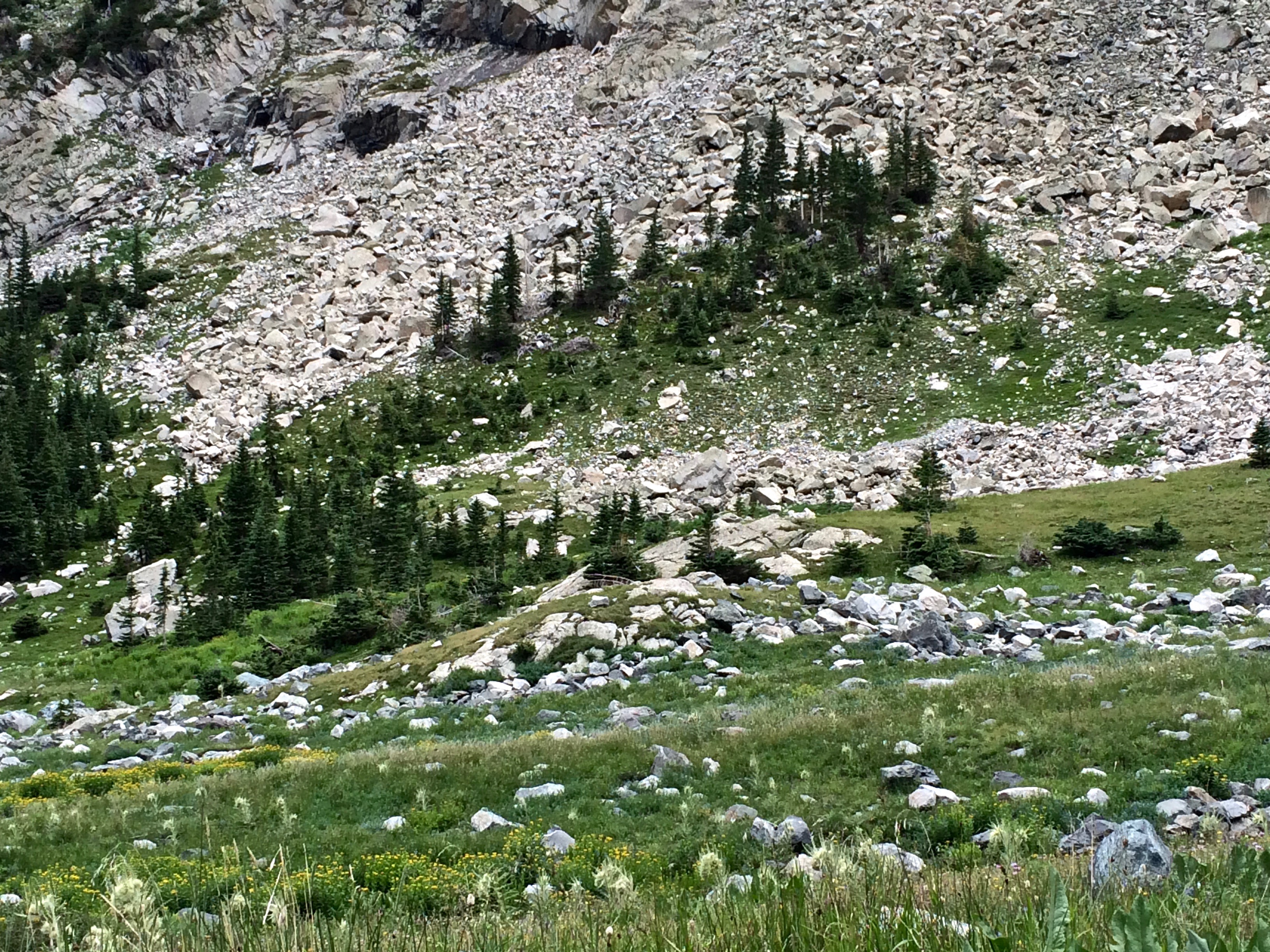
Avalanche-battered trees in upper Huérfano Basin, 2014. If you look at the two lower shots, you’ll see one-sided trees, decapitated trees, and a couple of bare, brown trunks with root balls–uprooted and moved downhill by the big slide in 2008. Many poems reference this basin and the trails both below and above.

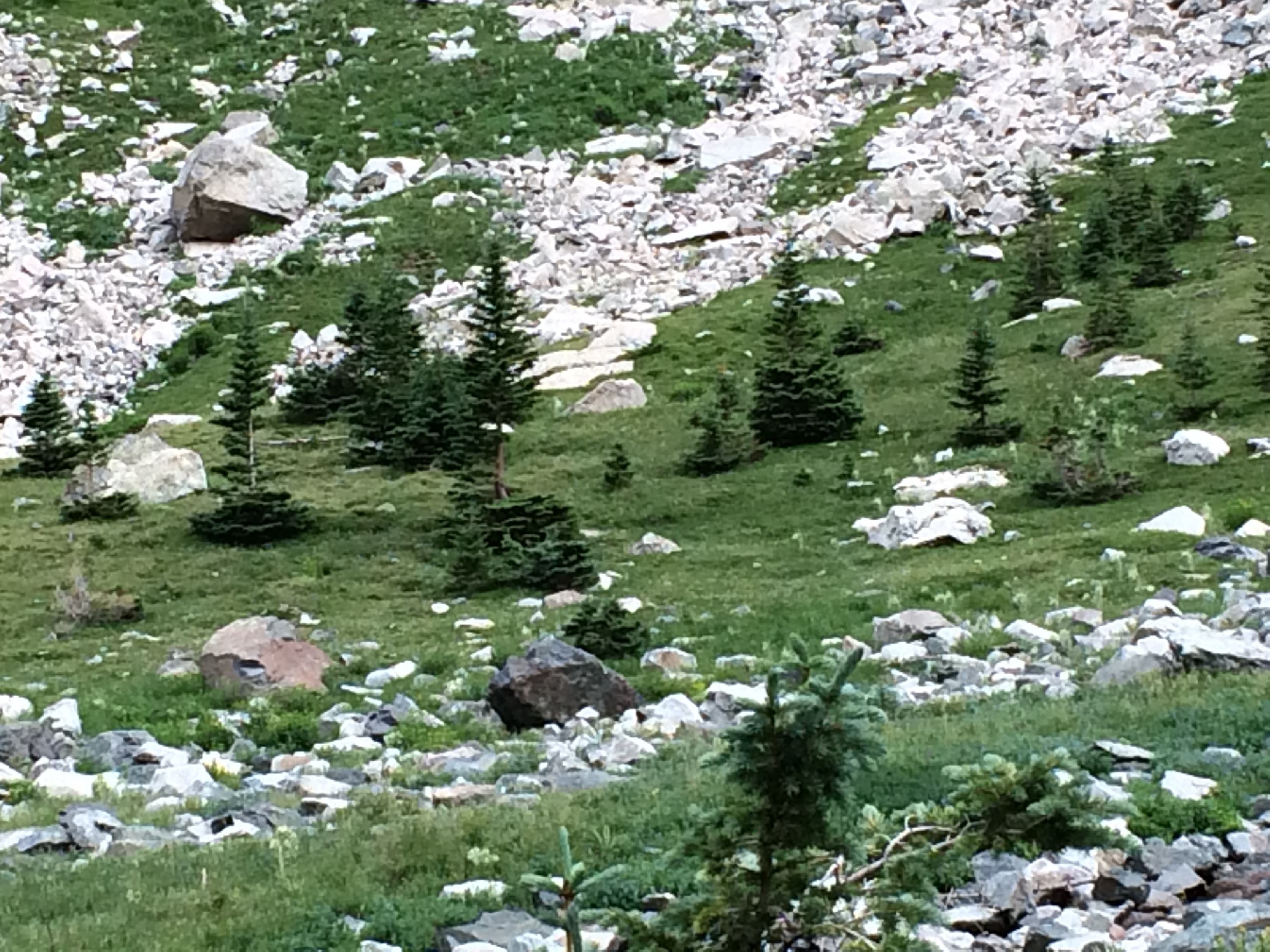
“A Tree at Its Birth Place, A Boulder at Its Resting Place,” upper Huérfano Basin, 2014. The gap in the tree shows the depth of snow when the avalanche passed over it, all its top branches having been shorn away. It survived and grew, preserving evidence of its past. Similar trees are referenced in “Not Lost, Exactly” as the charm / of a bare midriff/mid-drift…
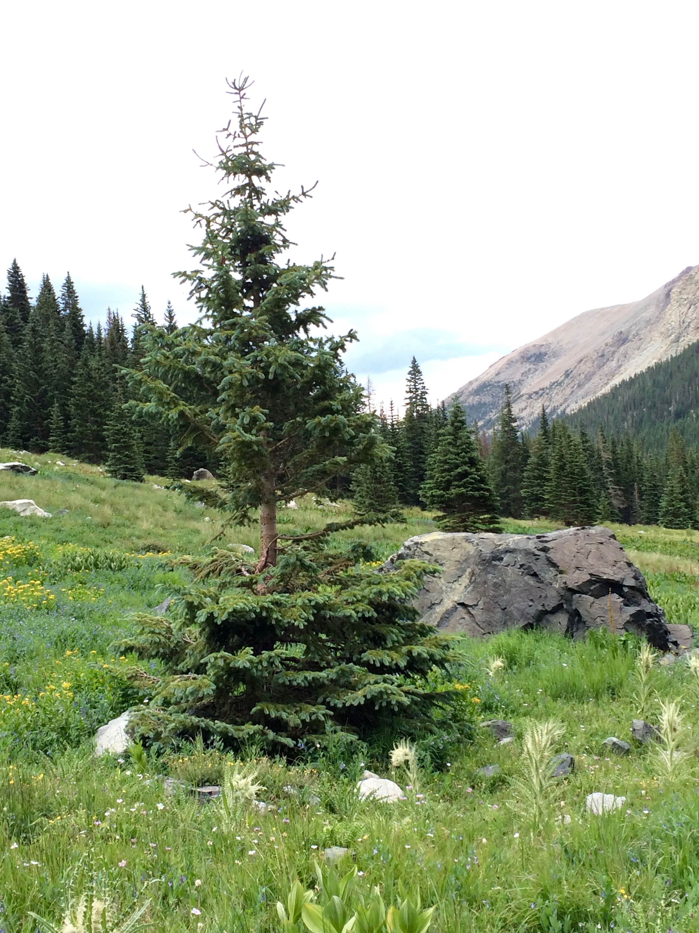
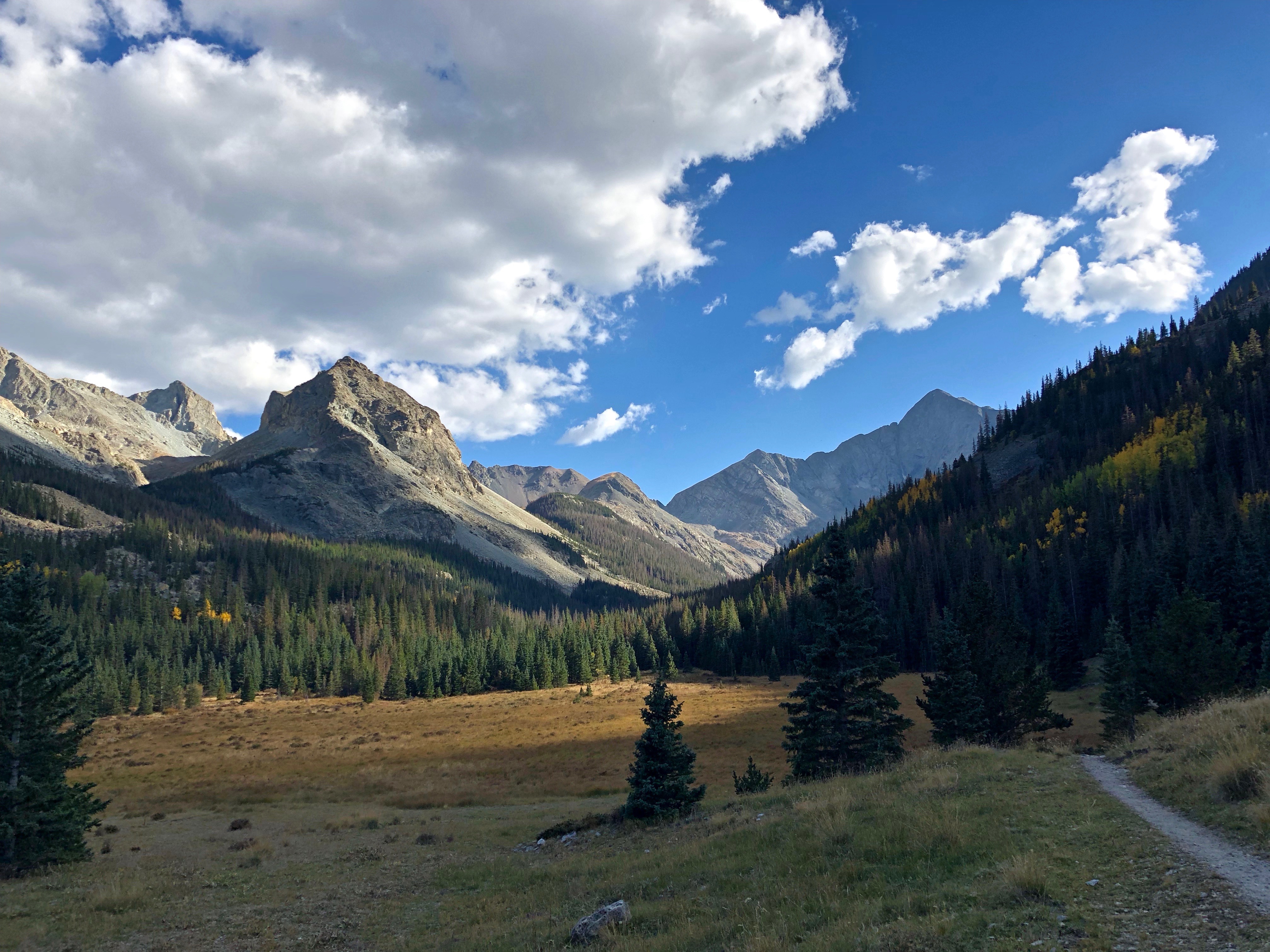
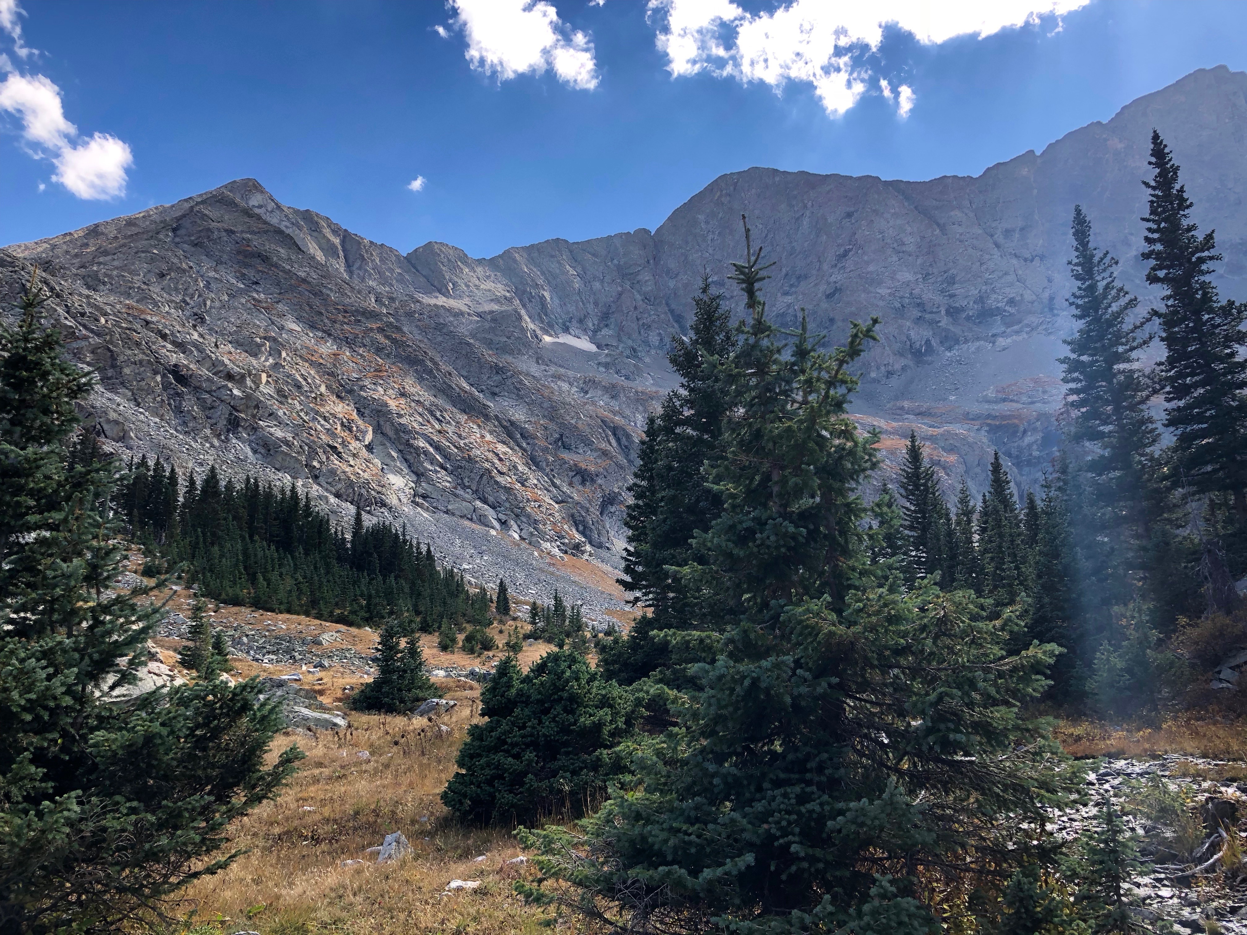
For context (and because I just can’t resist these photos) approaches to Huérfano Basin, September 2018.
Descending from the trailhead: Iron Nipple in left foreground, Blanca Peak in right background. Judgements differ as to whether that is the actual summit of Blanca.
The Huérfano River’s headwaters lie in the snowfields and springs of the upper basin.


Mudslide that closed the upper Huerfano Road in August 2016, for about a year. (Photo downloaded, photographer unknown, shot soon after the slide.)

My photo of the slide from below, shot from the new (temporary) road in September 2018, shows the extent of the collapse.
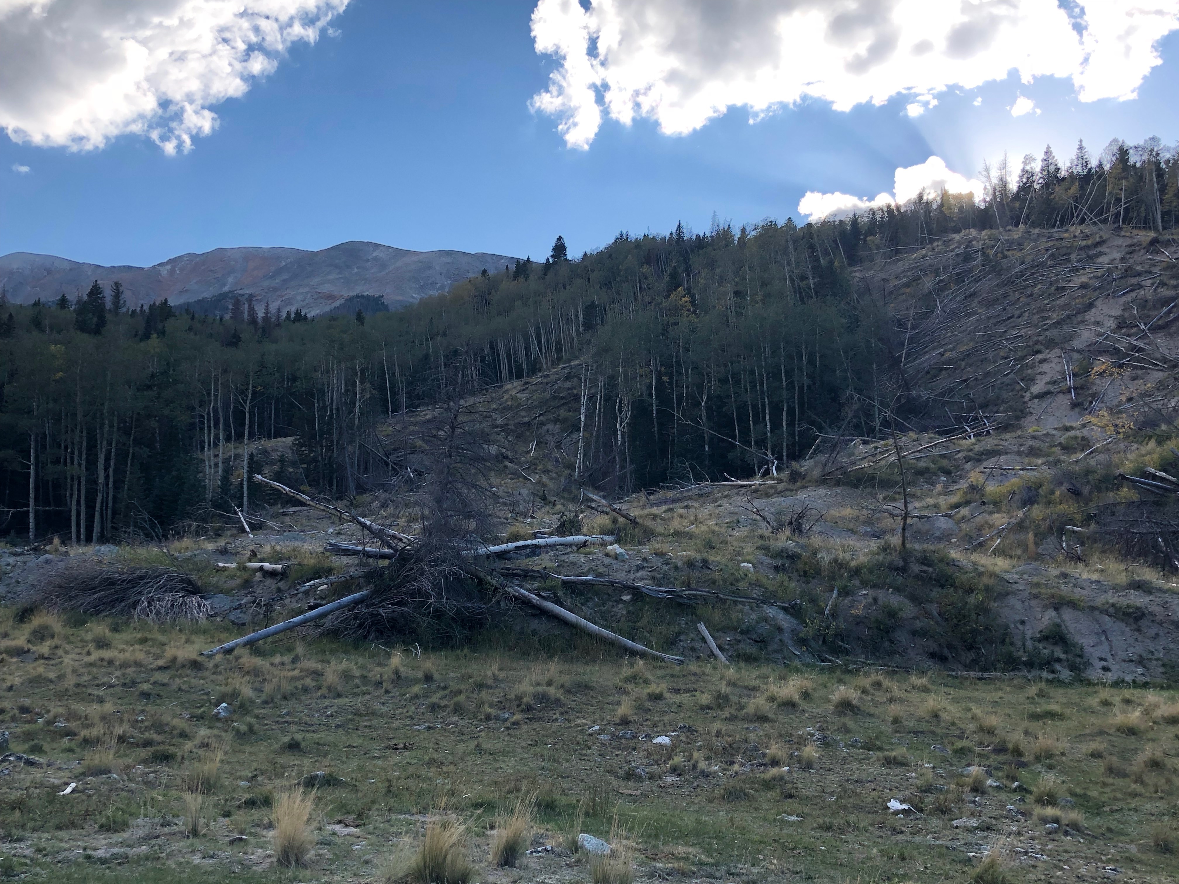
Notice that some trees fell uphill when the ground beneath them slid downhill. The good news is…that fucking mud-hole / where my truck slammed in- / to an aspen tree got wiped out in the slide.

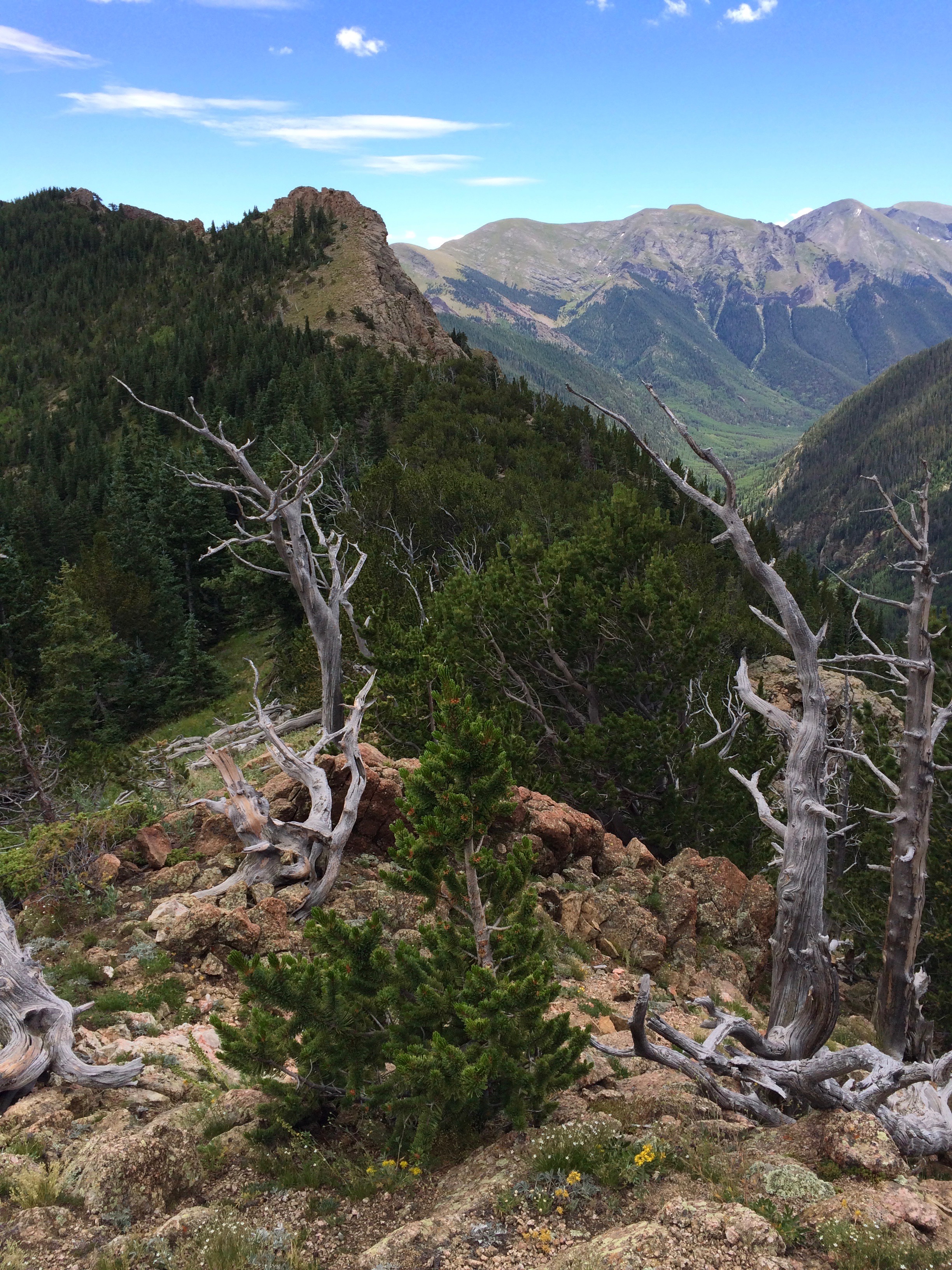
Photos shot on and from the ridge of Music Pass Trail, 2014 & 2018, setting of “Not Lost, Exactly,” “After Paradise,” “A Ghost,” the second half of “The Stones of Tamburlaine’s Army,” and parts of other poems.
From the pass looking west. Left to right: Tijeras Peak, Music Mountain, the distant and almost-hidden summit of Pico Aislado, and Milwaukee Peak. Upper Sand Creek drainage in the foreground. Three lakes lie at timberline in the Sand Creek drainage.

Avalanche paths (a.k.a. snow chutes) on an unnamed 13,369′ summit between Tijeras Peak and Music Pass. New-growth trees and shrubs are clearly visible in the chutes, result of too many years without enough snow to produce a forceful avalanche.

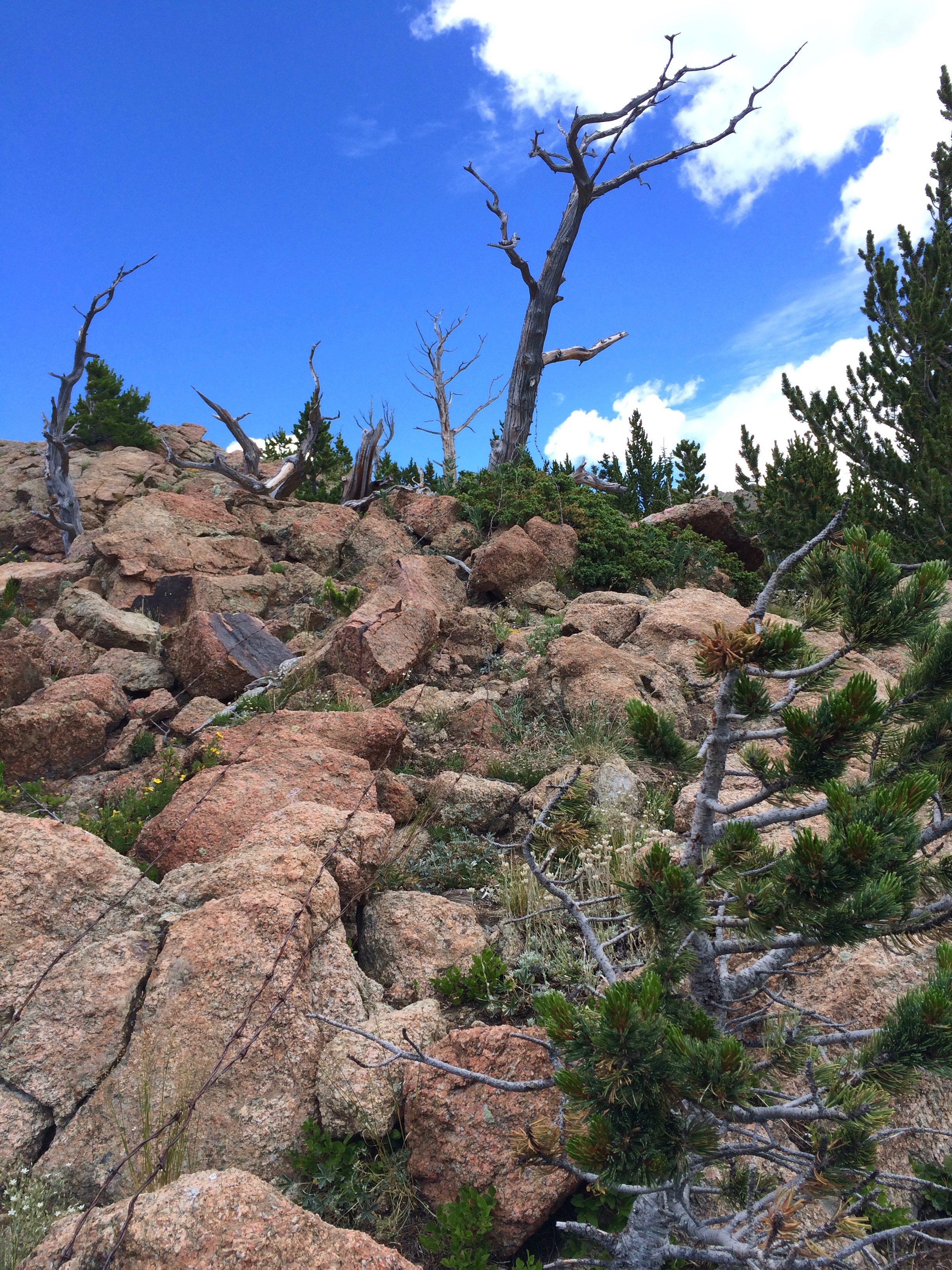
Ditto with a red rock & bristlecone foreground.

I call this The Everything Photo: snow chutes on the facing slope, beyond the valley of Sand Creek; lightning-killed bristlecones in the foreground, with the red rock of Music Pass ridge. The high knob center-left is Doug Cain point.
Red rock, barbed wire, & lightning-killed bristlecone pines.
North Taylor Creek & the Hayden Pass Fire, 10 July 2016.
The strange conjunction of snow chutes and drought-and-bug-killed trees.

Two avalanche paths–one curved (left), one straight (right), with dead trees in foreground and the first blow-up of the Hayden Pass fire billowing from behind the ridge.

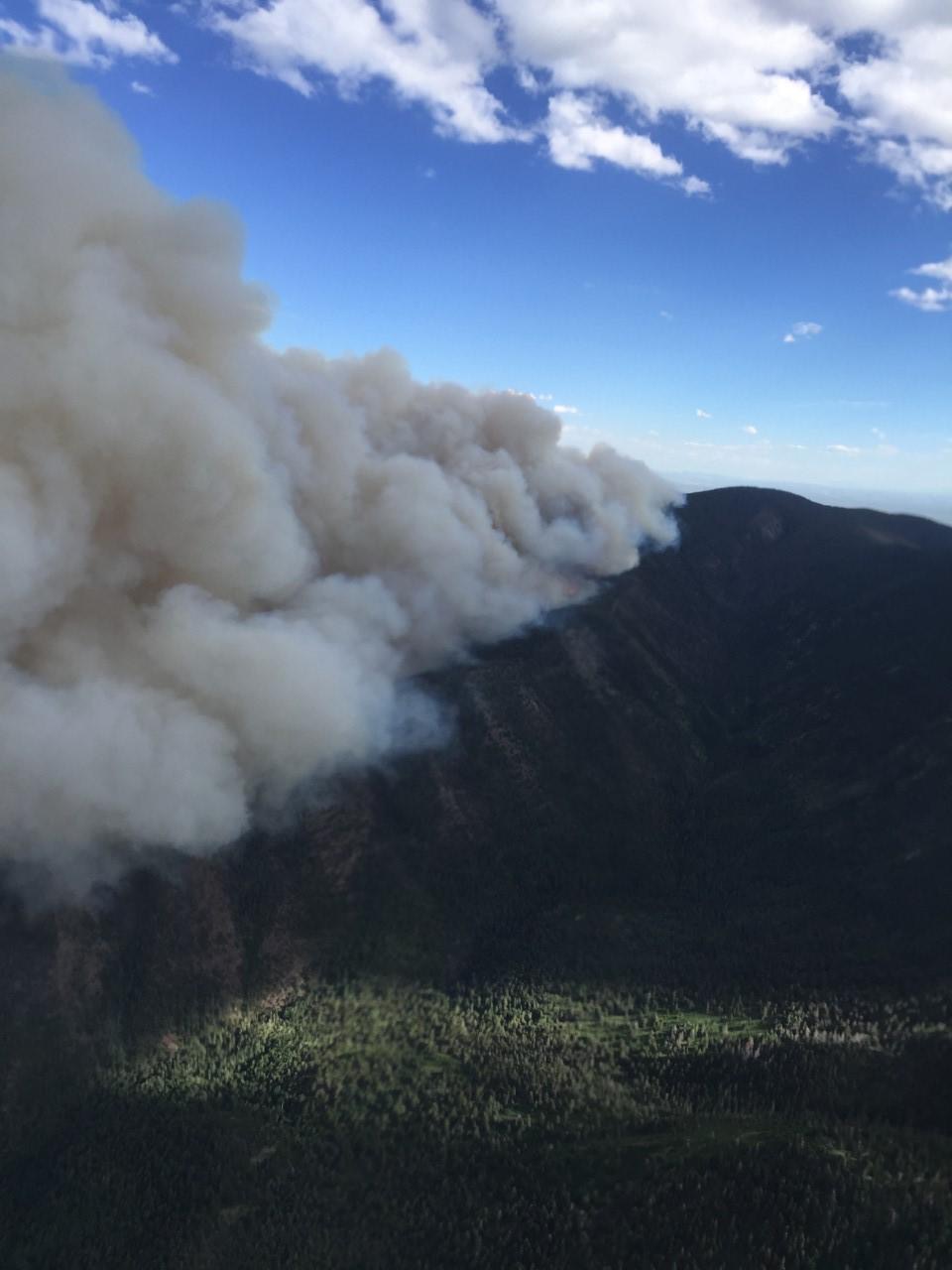
This downloaded aerial shot shows the Hayden Pass fire blowing up from its starting point high on the west (opposite) side of the Sangre de Cristos. (photographer unknown)
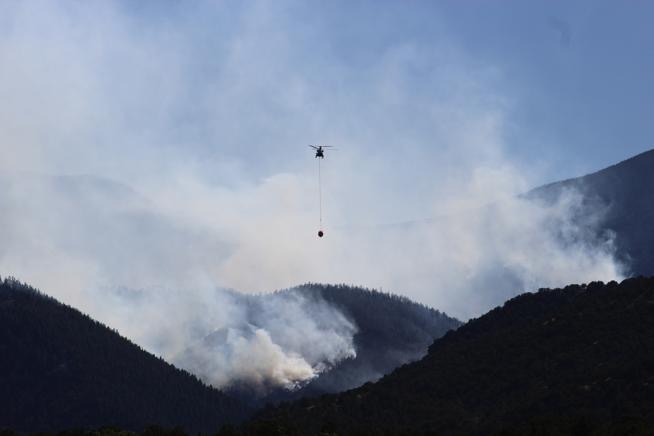
Downloaded photo of helicopter with water bucket, over the Hayden Creek fire. (photographer unknown)
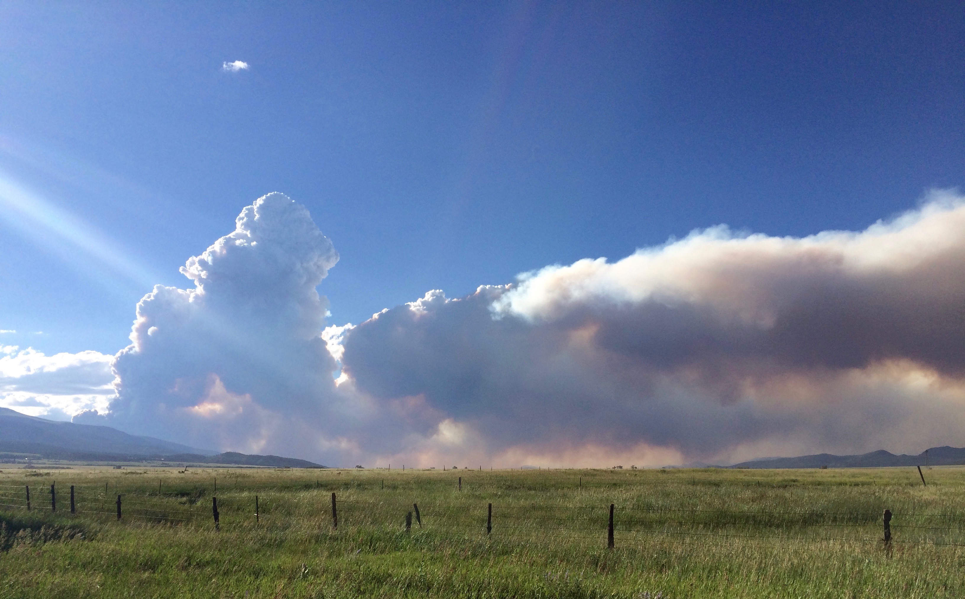
Two photos of the developing pyrocumulus cloud streaming east from the Hayden Pass fire. The smoke plume ran east to the Wet Mountains/Sierra Mojada, then curved southward. Some days it hooked from north of my cabin to east of my cabin, leaving me alone. Other days, I covered my face and swept falling ash from the steps.

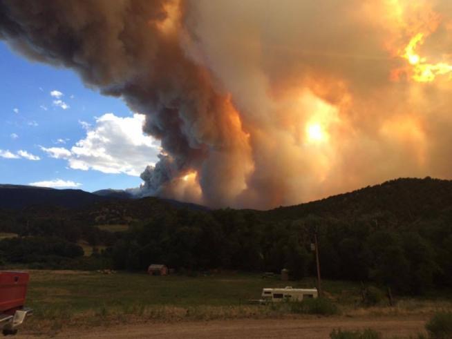
Downloaded photo of Hayden Pass fire as the sun sank westward, shot from the north
Coda: Crestone Needle in winter. (Photo: Custer County Search & Rescue Facebook page, 2014.)

Coda: my cabin, Hungry Gulch, @ 8,900′ in western foothills of the Wet Mountains/Sierra Mojada, on east side of the Wet Mountain Valley.

